

Well, our first couple of weeks in Canmore have been interesting. Any schedule that previously existed was promptly thrown out the window. Especially at night. Luci took a few days to adjust to her new surroundings, and Dota is still adjusting to her new sister. It might take years. Everything around here happens at warp speed—until it doesn’t. Luci reminds me of the Honeybadger, a former LSU and Arizona Cardinal cornerback. She will knock off anything that gets in her way. She actually bounces. All kidding aside, Lucia is a welcome addition.

Sunday morning - before the hike.
With that said, Dave and I left the pups and ventured out for our first hike last week. Elk Pass to Frozen Lake is an 8.4 mile out and back trail located by Lower Kananaskis Lake. The trail, an old fire road, eventually leads to Elk Lakes Cabin (maintained by the Alpine Club of Canada) and a backcountry campground.

It was about an hours drive from our place to the trailhead. The weather was cloudy and a chilly 45°. Our trek started off blissfully snow-free and dry. However, as we gained elevation, the dry trail turned to ice and snow—slowing our pace considerably.

What happened to the trail?

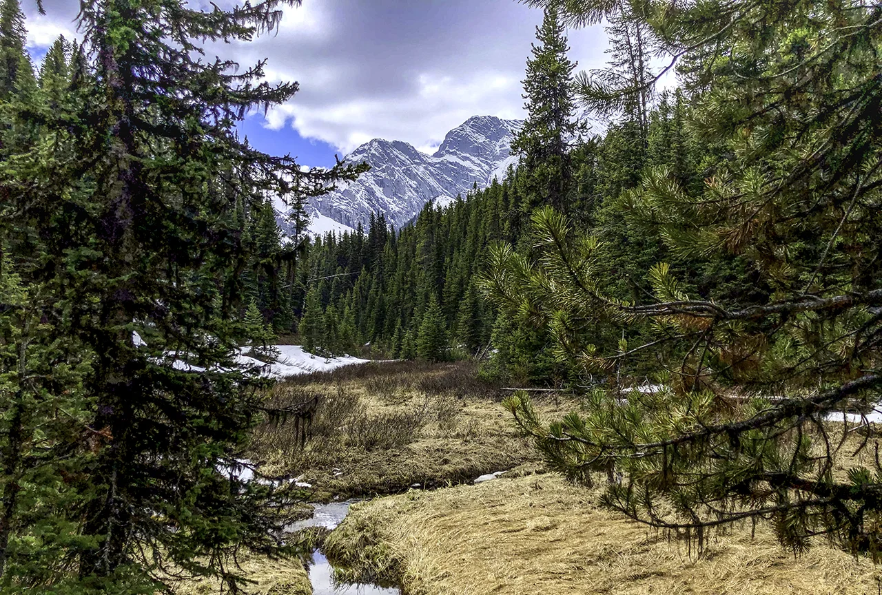
Fox Creek. No sign of moose.
We crossed multiple bridges, following some giant moose tracks in hopes of a sighting.

The Kananaskis range is daunting and massive. There were some impressive views to be had along the way.
Icy meadow. No sign of moose.
As the day progressed, the snow turned into slush. By the time we reached the meadow, it was a real mud-fest. We were about 3.5 miles in when we decided to have a bite to eat and head back.

Wildflowers blooming out of the bog.
Tired and cold, we were still content. For the first hike of the season, it was a splendid way to get our feet (soaking) wet.


