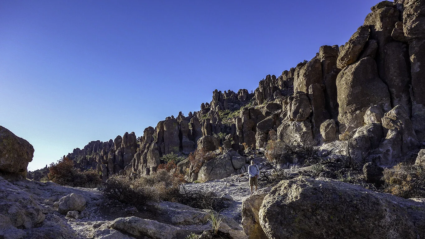
“The Crack” at Wet Beaver Creek—seriously? It’s hard to imagine a smuttier name for such a beautiful place. Who comes up with this stuff? I suppose it was named in a simpler time, a time when words had more literal meaning. Or—maybe someone just wanted a laugh.
Wow—I had no idea. Where has this gem been hiding? If you can get there to see the sunrise—do it. Peralta Trail to Fremont Saddle is a mesmerizing, challenging hike with a dramatic reveal.
The Superstition Wilderness in Gold Canyon offers many hiking opportunities. It is hard to believe that these towering hoodoos are the product of over 20 million years of erosion.
We arrived before dawn, and it was COLD and WINDY. Although dressed in layers, we wore shorts, which initially was quite unfortunate. Dave and I sat quietly in the jeep, toasting ourselves before venturing outside. We hit the trail at first light.
Rocky road.
Frankly, I don’t remember much of our adventure’s very beginning—we were too busy trying to warm up. Eventually, we stopped and took a look around. Massive columns of volcanic rock enveloped us as the sun broke over distant peaks. Phenomenal.
The roundtrip is a rocky 5.8 miles, with a total elevation gain of 1,330 ft. Allow at least four hours (more or less) to navigate the rocky terrain and soak in the beauty of the canyon.
Morning light.
Dave and I wound our way to the saddle’s base, where the real climb began. Switchbacks led to a smooth granite pass scattered with large boulders—a perfect place to grab a snack and pull out the iPhone. Splendiferous.
Smooth granite slabs (lower right), made the ascent easier.
Looking back from the saddle.
The pièce de résistance awaited at the saddle—Weaver’s Needle. This spire of fused volcanic ash rose from the valley below. A large remnant formed from over 20 million years of erosion, it climbs a thousand feet from the desert floor, with a summit of 4,555 feet. Rumors have it that the needle’s shadow casts the location of a cache of gold—part of the lore of the Superstitions.
Surprise!
Fremont Saddle.
By the time we made it down the rocky path to the parking lot, the lot was full. Even though the sun’s glare took some of the magic away, and our ankles and feet were stiff and sore, a brief scroll through our photos made us realize just how memorable this hike was.
Finally, it happened. After 110+ days of drought and intense heat, it RAINED. Not just a smattering of drops that move dust around—a lovely, rushing deluge. A much-needed cleaning of air, soil, and spirit.
Dark shadows and sunlight.
The next morning under clearing skies, Dave, Margaret, and I celebrated by hiking Tom’s Thumb Trail, located in the McDowell Sonoran Preserve. We started around 9 am—blissfully chilly through the first part of the hike. Layers were the key to comfort.
View from the beginning of the trail.
The trail is a steep one (1,200+ ft in elevation), but don’t let that stop you. There are plenty of waypoints to take a break and catch your breath while admiring the beauty surrounding you. The first mile is the hardest, but once you get to the first ridge, it becomes more moderate.
On our way up.
On our way to the Thumb.
After heavy rain, one would think that the trail would be muddy. Not in Arizona. The path, washed of small pebbles and dust, made the ascent and descent so much easier.
The Land before Time.
Tom’s Thumb.
Air, lightly scented with fresh creosote, combined with smogless skies, made the trip extra special. We snacked upon well-deserved clementines and molasses cookies before heading down.
Days like these are one in 110+.
Glistening saguaro.
There is nothing sweeter than a hike at dawn. Everything old looks new again, and when the sun rises over a mountain, it is nothing short of magical.
Memories of Yukon Cornelius come to mind when I think of Dixie Mine—a whole lot of nuthin’. However, the checkered past and expansive views it provided made the trip worthwhile.
Escapism [ih-skey-piz-uhm]—The avoidance of reality by absorption of the mind in entertainment or an imaginative situation, activity, etc. Yep, that seems to be the theme for surviving 2020. And our ticket to ride on the Verde Canyon Railroad filled the bill.
Stands of Aspen. Nirvana—especially for desert dwellers. However, the moment is fleeting—so make sure you plan well. Usually, Dave and I would have had our fill of fall in Alberta. Alas, —2020, has changed so many things. Thankfully, the beauty of fall is attainable only two hours from home.
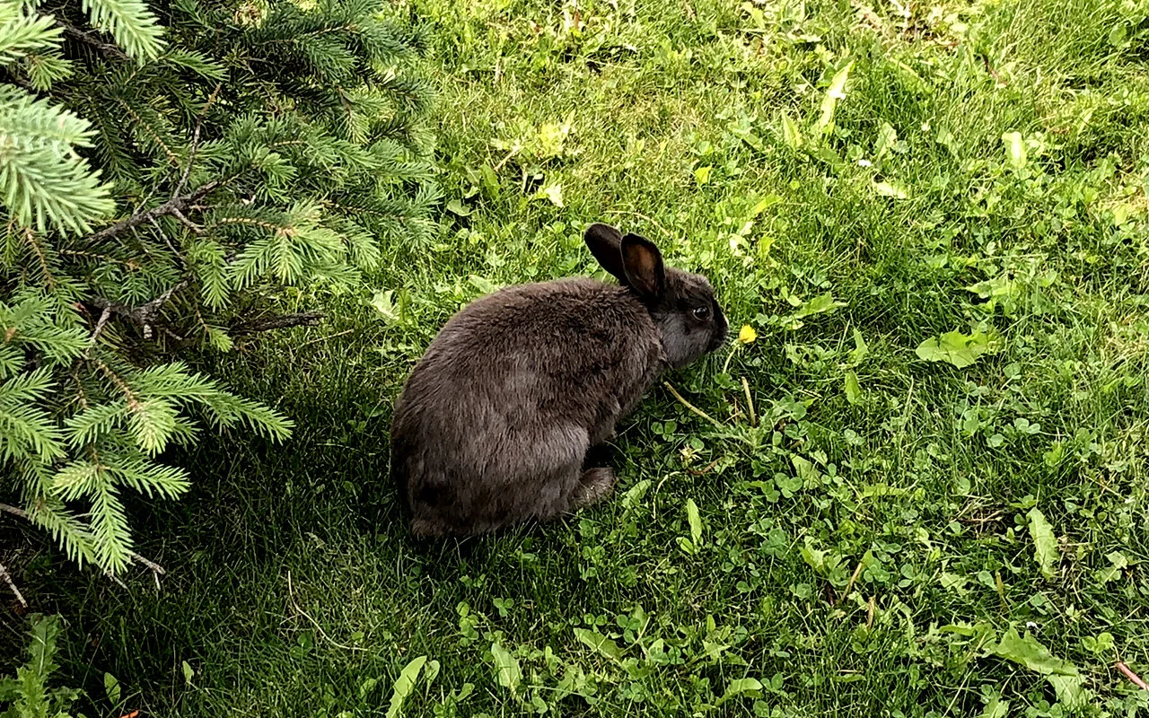
Dave and I had a Nat Geo moment last week. We witnessed a necessary battle for survival that didn’t end well for one of the participants involved.
If you’ve never visited the Granite Dells in Prescott, Arizona, go—because it is one special place. The Peavine National Recreation trail provides spectacular views of the dells and Watson Lake and is one of the few Rails-to-Trails projects in Arizona.
Still hot here. Yep. A broken record of record-breaking heat. However, the desert shadows are getting longer and the days shorter, so there’s hope.
Labor Day is upon us along with, you guessed it, record heat. However, in Arizona, we’ve turned the corner—it’s September, and October is just within sight. Hallelujah.
The hottest August on record. Wonderful. It’s hard to believe that this part of Northern Arizona was once a lush, tropical paradise—until the continents shifted. A LOT. I remember learning about the Petrified Forest as a youngster, perhaps by watching Captain Kangaroo—after all, that’s where I am pretty sure that I discovered Arizona even existed.
Nowadays, Dave and I feel a constant need to escape. Somewhere—anywhere. And with CoVid in full bloom, you can bet that we won’t be going too far.
We decided to take the pups along for the ride. After all, the pandemic had also disrupted their routine of chasing squirrels and climbing mountains. We packed up with dogs in tow, and headed north to the Petrified Forest National Park, located near Winslow and Holbrook—just off the famed Route 66.
The Wupatki National Monument is located about 18 miles from Sunset Crater Volcano National Monument. Although we were never far from the highway, the landscape became vast and vacant, and somewhat empty feeling. We could see Vermilion Cliffs and the expansive painted desert before us.
We must have passed the entrance to this place dozens of times on our way to somewhere else. It’s crazy that in all of the years we’ve spent in Arizona, there are so many sights we haven’t seen. Sunset Crater Volcano National Monument was one of those destinations.
Sometimes the best way to accomplish a goal is not to define it. Just enjoy the process.
Towering at 10,425 ft, Kendrick Peak, a dome volcano, is one of the highest in the San Francisco Volcanic Field. The Kendrick Peak Trail #22 was about 9 miles roundtrip, with a 2,700 ft elevation gain.
Just minutes southeast of Flagstaff lies a lovely little trail that shows a different take on Walnut Canyon. Petrified sand dunes, canyon gorges, and caves—what a combination.
As temperatures rise in the desert, so does the need to escape. That’s where Dave and I found ourselves last week. With the border to Canada closed for at least another 30 days, we agreed to suck it up and make the best of the current situation.
“When the dog bites, when the bee stings, when I’m feeling sad, I simply remember my favorite things, and then I don’t feel so bad…”
—Rogers and Hammerstein, My Favorite Things
Mountainside wildlife.
This love letter should come as no surprise. Our family’s roots run deep in Alberta. My father was born Lethbridge, and I have memories of visits to not one, but two sets of grandparents.
Close to twenty years ago, we ventured into this little town—this Valhalla. Canmore is where I fell in love with Dave. It’s where our lives came together, and our hearts lie still.
Canmore overlook at sunrise.
It seems every April, like clockwork, the urge to go north sets in. Dave dreams about crystal clear lakes and rugged mountains. We binge-watch all the movies we can find that use the Canadian Rockies as a location. We crave poutine. In essence, we shift gears.
Spray Lake.
What’s outside your window?
Canmore Golf and Curling Club.
Bow River evening walk.
Not unlike the Canadian geese who winter in Arizona, in May, we take flight—only to return to the desert by November.
September in the Canadian Rockies.
But this year is different for everyone. Isolation is not by choice, it’s mandatory. CoVid-19 continues to take its toll on the lives and livelihoods of so many worldwide.
So we all wait, hope for better days ahead, and remember our favorite things.
Despite fires, floods, and global pandemics, Canmore, you will always be our home away from home. XOXO.
If hiking the Grand Canyon is in your future, and if you have never seen the Sierra Estrella wilderness, then this is the hike for you. This hike wasn’t about the view—it was about a non-relenting climb to nowhere. Alright, so maybe I’m a bit brutal. It was a quarantine hike.
Arizona trails are essential services. Thankfully, with our vast trail system, it’s not difficult to find an uncrowded venue. Skip the Camelbacks and Piestawas—unless you enjoy wiping down boulders and guard rails that have been touched by thousands.


