High Ho

1 Comment

High Ho

Dave’s father and grandfather worked in the mines. Iron mines, to be specific. So his interest in mines and mining comes naturally. Over the years we have explored the iron mines of Hibbing, MN, as well as the coal mines of Canmore, AB.

Arizona happens to be one of the largest suppliers of copper. One of the three Cs. And that’s how a trip to Bisbee came into play. How about an underground mine tour in a historical little town not too far from here? Done and done. We invited Steve and Julie to join us. The stage was set for another adventure.

Bisbee, Arizona

Bisbee, Arizona

Bisbee was once known as the Queen of Copper Camps. Over almost a century of mining, this hotspot produced 8 billion pounds of copper, 102 million ounces of silver and 2.8 million ounces of gold. It was the place to be. The town prospered until 1974 when reserves were depleted and the mines shut down. Real estate plummeted, and the Queen became tarnished. 

bisbee hi rez edit-3.jpg

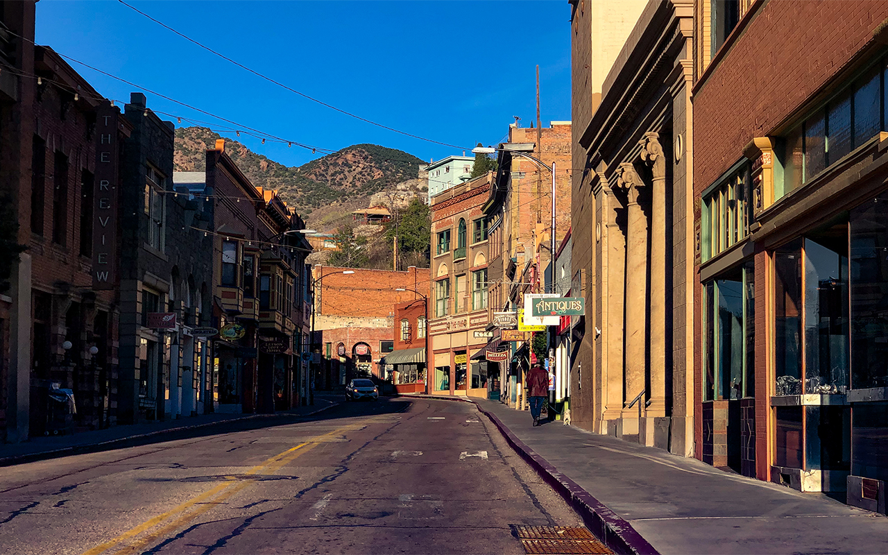
Bisbee’s only option was to reinvent itself. Gradually, artists, developers and small businesses moved in. Today, it is a thriving, funky, artist’s haven—full of shops, bars and hotels lining its narrow winding streets. With it’s lively nightlife and historic charm, it has become a bit of a tourist mecca.

Mine entrance.

Mine entrance.

Very serious.

Very serious.

We arrived in town just in time to grab a bite to eat at the Stock Exchange Bar and Grill before the Queen mine tour. It was cold, cloudy and windy day—perfect for going underground. Despite the weather, all of the tours were booked solid.

Tour time. We were given a hardhat, a nifty flashlight, and a vest to wear before entering, then squeezed onto a tram that looked like something the Seven Dwarfs would ride on. High Ho. It wasn’t as if you sat on this contraption, you folded yourself onto it. This was not Disneyland. 

Into the tunnel we go.

Into the tunnel we go.

Left: A copper vein surrounded by lead, illuminated by Dave’s flashlight.

Left: A copper vein surrounded by lead, illuminated by Dave’s flashlight.

This is not a tour for those who do not like to be confined. Although Dave tends to be claustrophobic, I was the one who seemed to have more of a problem. Once we entered the mine everyone was using their handy flashlights to explore their surroundings. The barrage of flashing light made me a little nauseous.

Making our way up to one of many chambers.

Making our way up to one of many chambers.

Our tour guide was excellent in relaying what it was like to work down there. Maybe he was too good. When he mentioned how air was pumped in the many caverns - all I could think of was how still and damp everything was. Then he mentioned water, and I became fixated on how thirsty I was. We climbed up a narrow stairway to a large chamber used for mining. Meanwhile, Dave continued to shine his light incessantly - looking for veins of copper in the rock. Steve and Julie listened intently to our guide. I broke into a light sweat. 

We all learned a lot that day.  Our last stop contained an unusual boxlike structure on tracks, that could be moved from room to room. People seemed to be fascinated with it. They lifted the lids and peered inside. Strange. To me, it looked kind of like a shoe shine stand. Suddenly, our guide broached a rather sensitive subject. “When miners had to—you know—go, did they have to hold it all day?” Eewwww. That was no shoe shine stand. It was a portable toilet. 

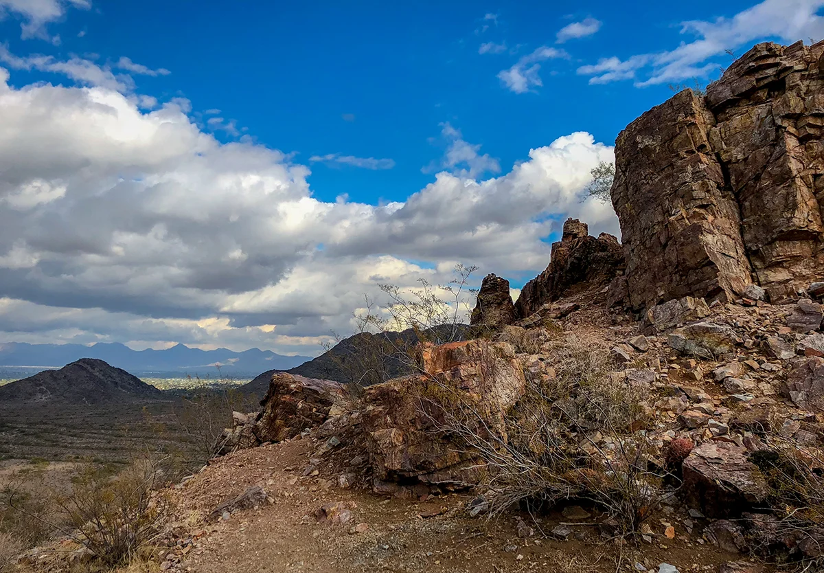
After the tour, we decided to take a hike up the mountain to see Bisbee from above.

Bisbee trail guide.

Bisbee trail guide.

Our climb up the hill led us to Jesus. Sorry, not really. Although the figurine had an affinity for chickens and was slightly disturbing, it did point the way to some pretty nice views. 

Bisbee from above.

Bisbee from above.

Looking towards Mexico.

Looking towards Mexico.

Bisbee essentially died when the mines shut down, as did Canmore. I guess change is inevitable. It is heartening to know however, that over time, these little towns not only survived, but recreated themselves without destroying their heritage.


1 Comment

White Tank Wildflowers

Comment

White Tank Wildflowers

Margaret is one of my favorite people. After all, we did work together for over 20 years. We have shared more up and downs than most do in a lifetime. And, it was Margaret who told Dave and I that the wildflowers were in bloom. So last Saturday, we packed some fruit and sandwiches and headed off to the White Tanks for a group wildflower hike. 

White Tank Mountain Regional Park, Mesquite Canyon trail.

White Tank Mountain Regional Park, Mesquite Canyon trail.

At 30,000 acres, The White Tank Mountain Regional Park is enormous. It features several canyons and rises from the base to over 4,000 ft. The name White Tank comes from the depressions (or tanks) that hold water in the white granite rock—created from erosion and flash flooding. 

A winding golden pathway

A winding golden pathway

The breezes that day were cool and plentiful.

As we rounded a corner, we were greeted by green hillsides covered with purple, orange and gold. Narrow pathways were lined with poppies, giving the trail a wedding-like feel.  

white tank hi rez edit-7.jpg

With the trail being six miles long, our plan was to have lunch at the midway point. Boy, were we mistaken. As we approached a trail junction, the signage indicated that we had hiked 4.5 miles and had 4.1 miles to go. Argh. Needless to say, it wasn't long thereafter that we stopped to eat. Thank goodness for chicken salad and clementines. 

Margaret on the trail to who knows where.

Margaret on the trail to who knows where.

The land of lizards.

The land of lizards.

As we worked our way back down, it got kind of quiet. All business. Suddenly, a rather LARGE lizard scrambled across the rocks close to the trail. Our energy levels were immediately heightened, albeit for only a moment. The ample sun became glaringly obvious. We were all becoming a little toasty. 

Our once leisurely pace kicked up a notch. All eyes on the prize (jeep). Before too long, the parking area came into view and was met with smiles all around. 

Poppies. That will make them sleep…..

Poppies. That will make them sleep…..

Overall, it was splendid outing, full of color, adventure and surprises. Worthy of the extra mile—wait—make that three of them. 


Comment

Before the Bloom

Comment

Before the Bloom

Lawn umbrella nose dive.

Lawn umbrella nose dive.

Then the rains came. And the hail. Not to mention a phenomenal amount of snowfall in the high country. Many were stranded in Flagstaff and Payson for days. Road closures, flooded washes—the whole nine yards. Enough precipitation to move the drought needle a bit.

In the midst of the storm we were greeted with a thud on the roof and an lawn umbrella impaled in the front yard. At first, we thought it was ours, but then discovered it had flown from our neighbor’s backyard. After about three days, the cold front passed.


I think hiking after a big rain is the BEST. The scent of creosote and mesquite fill the air, the trails are tamped down and dust free and the views—glorious. With that in mind, Dave, Dota and I ventured out to the Dreamy Draw, to hike our favorite 4-mile loop.

Trail 100 was full of color.

Trail 100 was full of color.

dreamy draw 2-22-19.jpg
Snow!

Snow!

After reaching the top of the first hill, we were surprised to see the mountains to the east, north and west were dusted with snow. Pretty, pretty good.

dreamy draw 2-22-19-7.jpg

Dreamy Draw was glistening and abundantly green.

dreamy draw 2-22-19-8.jpg
dreamy draw 2-22-19-9.jpg

A gift from the desert to its inhabitants. And most likely a sign of wildflowers to come.


Comment

Sunday Drive

Comment

Sunday Drive

Dota is skeptical…

Dota is skeptical…

This winter has been unseasonably chilly. For a while there, we were at least 20° below normal. Whine. Seriously, in comparison to the rest of the country, we’re doing just fine. So on one of those clear, cold Sundays in mid-February, Dave, Dota and I bundled up and took a drive past Carefree to the Seven Springs recreation area in Tonto National Forest. This site and nearby campground was constructed by the Civilian Conservation Corps in 1934. The higher elevation (3,500ft.), shade and flowing water make it a popular respite during summer months. The area is also known for some of the most abundant winter birding in Maricopa County. Unfortunately, it is also known for flash floods and wash outs during the rainy season.

Passing through the Bartlett wash area, before the pavement ends.

Passing through the Bartlett wash area, before the pavement ends.

Around the bend.

Around the bend.

Getting there was almost as fun as the hike itself. Forest Road 24 turned to gravel about 9 miles in and became quite narrow, featuring plenty of blind curves and steep cliffs. The perfect location for a car commercial. We were in nowhere land—one could get lost around here and never be found. Along the way, sportsmen could be seen taking aim at some makeshift targets. The Wild West.

Off the road to nowhere.

Off the road to nowhere.

We piled out of the Jeep into a fairly empty parking area. There were numerous trails to take from this location, but our plan was to take a leisurely hike down by the creek (CaveCreek #4). 

A beautiful creekside path

A beautiful creekside path

IMG_3757-2.jpg

Lush and green. Cave creek is home to sycamores, cottonwoods and willows. Prickly pear and Juniper covered the hillside. We also saw little cactus“condos” growing out of the rock trailside.

Cactus condos.

Cactus condos.

Cave Creek.

Cave Creek.

We followed the well-maintained trail until it kind of ended. A lengthy discussion of how to cross the creek ensued. We entertained thoughts of moving logs, repositioning rocks, as well as adding to existing rock piles—with no intention of even trying it out. Semantics. Getting wet that day was not part of the plan.

The amazing view from the PRIVATE road.

The amazing view from the PRIVATE road.

Raccoon tracks.

Raccoon tracks.

With that in mind, we turned and took a detour to the road above. There, we spotted numerous  javelina and raccoon tracks. It wasn’t until we got to a locked gate that we realized we were on private property. Whoops.

By the time we headed home, it was pretty darn cold outside. Dave said it felt like it was going to snow. Little did we know…


Comment

Thumbs Up

Comment

Thumbs Up

I know, I know. it’s a corny title, but I couldn't help myself. For locals and tourists alike, Tom’s Thumb trail is not to be missed. Managed and impeccably maintained by Scottsdale’s McDowell Sonoran Conservancy, the area offers trails for all levels of experience, including rock-climbing. The Visitor’s Center is a work of art in itself. 

Trailhead Visitor’s Center

Trailhead Visitor’s Center

A beautiful hike, from beginning to end.

A beautiful hike, from beginning to end.

Dave and I hiked to Tom’s Thumb the Sunday before New Years. Bright, sunny skies and pristine air. The trail was full of tourists in for the Fiesta Bowl. Being the loyal LSU fans that we are (another time, another place), we scanned the masses, looking for purple and gold. No such luck—mostly UCF colors. Not a problem, merely an observation.

The sun was just starting to break the ridge.

The sun was just starting to break the ridge.

BTW, Tom’s Thumb trail is quite steep (1,200+ft in elevation), but relatively short (4 miles roundtrip). Although it’s rated as difficult, we’ve seen all hikers of all ages make the trek. Dave and I took our time—stopping along switchbacks to admire the view and catch our breath. When we reached the ridge just before the thumb, we were greeted by trail volunteers who were answering questions and congratulating hikers on their way up. A nice touch.

Rocky. Gorgeous. Desert. Views.

Rocky. Gorgeous. Desert. Views.

The trail to the east takes you to a view of Fountain Hills.

The trail to the east takes you to a view of Fountain Hills.

North Scottsdale is behind me.

North Scottsdale is behind me.

Spectacular panoramas at every turn. Tonto National Forest, Bartlett Reservoir, Four Peaks, Fountain Hills, and Scottsdale Airpark were all visible from the top. In addition to being an awesome photo-op, Tom’s Thumb is also a well-known nesting area for Peregrine Falcons.

Tom’s Thumb

Tom’s Thumb

Our descent was a slip-sliding extravaganza, full of people-dodging and skiing down loose rock. Fortunately for us, all good things came to an end. It wasn't too long before the Visitor’s Center and our Jeep came back into view.

Homeward bound.

Homeward bound.

Quick question: Why is it that hiking down can be so much more difficult that hiking up? For me, I think it it must be that I’m kind of tired and not as focused. Hmm, maybe I’m looking forward to happy hour rather than the task at hand. A reward for effort? Why not? Not long ago, I heard two hikers asking each other, “Do you eat to hike or hike to eat?” They eventually decided that they hike to eat. I’ve come to realize that Dave and I are quite fond of doing both.


Comment

A Happy Tail

Comment

A Happy Tail

Puccini and Dota, exploring, last summer in Canmore, AB

Puccini and Dota, exploring, last summer in Canmore, AB

When Puccini passed away last December at the ripe old age of 16, Dota became our one and only pet. She’s a spunky gal, known for hunting squirrels up in Canmore, as well as chasing lizards down here in Phoenix. And, she LOVES to ride in the Jeep—wait, make that any motor vehicle. Happily, Dota’s sense of adventure and love of trails are back to full strength, thanks to numerous hikes of late.

Last weekend, we took her to one of our favorite spots off of Tatum Boulevard. The lot has only a few spaces and is usually full, but one can usually find parking on one of the side streets nearby. The trail is popular with mountain bikers as well as hikers, and is a great starting point to link to other trails within Phoenix Mountain Preserve.

Not far from the trailhead

Not far from the trailhead

It was one of those rare cloudy overcast days. Nice. Not too hot, no glaring sun. The beginning of the trail resembled a desert botanical garden, full of Paloverde and all kinds of cactus. It felt like we were walking though a neighbor’s backyard desert landscape - which, by the way, we kind of were. A short section of the trail passes through a wash between residences.

Headed towards the ridge.

Headed towards the ridge.

Once we got to the top of the initial ridge - Dave and Dota and I took a detour, on a lightly travelled trail that went up a small mountain off to the south. We wove our way to the top, stopping to look at emerging wildflowers, trails and the city below.

Purple wildflowers covering the mountainside.

Purple wildflowers covering the mountainside.

Just the beginning…..

Just the beginning…..

View of Phoenix Mountain Preserve.

View of Phoenix Mountain Preserve.

Little Dota, mountain dog.

Little Dota, mountain dog.

By the time we reached the Jeep, we could tell Dota was satisfied. Not a peep out of her on the short ride home. A long nap ensued. For a little dog of nine years, it’s nice for her to know that not every ride in the car means VETERINARIAN.


Comment

Desert Wave

Comment

Desert Wave

It’s primetime in the desert. The Phoenix metro area swells with Canadians, Midwesterners, and all those who seek solace from the frigid cold of winter. And it’s only February. So, when Dave and I decided to hike the popular Wave Cave trail, getting there early was essential.

The trail is located in the Superstition Wilderness area, in Gold Canyon, Arizona. Just about an hour’s drive from our home. Despite our early start, the trailhead parking area was almost completely full. Thankfully, we were able to squeeze in between a couple of trucks. It was breezy and cool, and breathtakingly beautiful.

Dave heading up the trail.

Dave heading up the trail.

IMG_3619.jpg

Overall, most of the hike was pretty mellow. The elevation gain was gradual—filled with sunlit cholla and large stands of saguaro. We could only imagine what hiking this would be like in a month or so, when the cactus are in bloom.

IMG_3629.jpg

Oh yeah, but then it got steep. REALLY, REALLY STEEP. The closer we got to the cave, the steeper it became. Narrow, with lots of loose rock. The sense of accomplishment felt as we scrambled to the top made it all worthwhile.

View from the back of the cave.

View from the back of the cave.

The cave was deep, sheltered and protected. A massive wave-like formation formed from thousands of years of erosion rose from the floor of the cave’s mouth. A perfect place to view the desert below or take the quintessential pipeline shot.

Sitting on top of the world.

Sitting on top of the world.

The wind created small dust devils just outside the cave, creating a beach-like atmosphere.

IMG_3655.jpg

I’d have to admit, for the first quarter mile, the trip back down was a little scary. I couldn’t decide whether to stand or crawl—so I did both. The Palo Verde limbs along the trail were smooth and shiny—most likely from the grasp of every hiker that passed by. As we headed down, we crossed paths with multiple groups of hikers headed upward. I couldn’t help but think, we sure timed that hike well.


Comment

Space and Time

1 Comment

Space and Time

Lost in space. That best describes how one feels in Monument Valley. It took us less than two hours to travel from Canyon de Chelley’s deep canyons to Monument Valley’s buttes and spires. John Wayne country, indeed. From memories of Road Runner and Wile E. Coyote, to The Ballad of Buster Scruggs, we felt as though we were entering a giant movie set. Amazing.

Artist’s Point

Artist’s Point

Monument Valley is really not a valley. It is a flat, that’s interrupted by towering formations formed though the endless erosion by water, wind and ice. Did I just mention wind? The day we visited, was really windy, with gusts clocking in at 30-40 mph. 

The best way to see the area is to drive the 17-mile dirt road that loops around Rain God Mesa. A four-wheel drive is recommended, but Steve took the challenge (and won) with his SUV. There were no crowds or lines. Just wind. My understanding is that this road gets quite backed-up in the spring (a sea of cars) and that flash floods can occur from June-August. We really got lucky with our weather, as the offseason is often unpredictable.

A glimpse of Valley Road.

A glimpse of Valley Road.

IMG_3178.jpg
IMG_3296.jpg
While pelted by sand, we captured the Three Sisters monument

While pelted by sand, we captured the Three Sisters monument

The color and light was in Monument Valley is something to behold. Strong winds kicked up a lot of sand, creating a painterly effect on many of the photos we took. No enhancements needed. We stopped along the many pull-outs to take photos and marveled at the vast beauty of the Navajo nation.

John Ford’s Point

John Ford’s Point

Stagecoach, 1939

Stagecoach, 1939

John Ford’s Point is a well-known and aptly named. He used this particular location in many of his films. Post adventure, Dave and I watched Stagecoach, where Ford used the iconic vista at the beginning and the end of the film. To us, there was a bit of an issue with that decision. The stagecoach was making the journey from Tanto, Arizona to Lordsburg, New Mexico. Seems like they didn’t make much progress. Just saying…

Late afternoon view from Lee Cly Trail

Late afternoon view from Lee Cly Trail

Click, click, click. The sunrise view from everyone’s balcony.

Click, click, click. The sunrise view from everyone’s balcony.

The drive took up most of the afternoon. Our evening was spent dining on more frybread at The View motel. We awoke to a spectacular sunrise, courtesy of our room’s balcony. What a view! The steady click of cameras made it abundantly clear that we were not alone in this endeavor.

Early morning view from Wild Cat Trail.

Early morning view from Wild Cat Trail.

Before departing, Julie suggested a quick hike along the Wild Cat Trail that ambles towards Mitten Butte. It was chilly, but also crisp, clear and blessedly still. The sand along the trail was pristine, and untouched, like the beach of an ocean, just washed by the tide.

The sands of time.

The sands of time.

By 3pm, we were back in Phoenix. All of us felt strangely disoriented, as if we had been gone for much longer than two days. In hindsight, I’m thinking that our adventure was a great form of time travel, simplified.


1 Comment

Time and Space

1 Comment

Time and Space

A time machine. That’s what it was. Imagine driving for four hours and finding yourself in world of canyons and mesas. Looking down one day and up the next. And, by the end of the two-day adventure feeling like you have been gone a very, very long time. 

Peering down into the one of several canyons

Peering down into the one of several canyons

We left early on a Friday with our good friends Steve and Julie, and arrived in Flagstaff shortly after sunrise. It was a crisp and clear November day, the kind tourists dream about. After driving for what seemed forever through desolate reservation land, we reached our first destination. Just past the town of Chinle, is Canyon de Chelley, an Arizona National monument and part of the Navajo Nation. The land’s rich history spans close to 5,000 years, from the early Anasazi dwellers to the Navajo families that still live there today.

Steve, Julie and Judy taking in the sights.

Steve, Julie and Judy taking in the sights.

Navajo farm deep in the canyon.

Navajo farm deep in the canyon.

Ahhh, the benefits of visiting off-season. No crowds. Plus, we got lucky with the weather. That afternoon was spent peering into giant crevasses at ancient ruins, tidy farms, and geological wonders. Deep canyons cut by streams from the headwaters of the Chuska River.

Antelope House Ruins

Antelope House Ruins

Hiking White House Ruin trail provided us with a chance to look up and experience how it must have felt to live within the steep canyon walls.

White House trail, Canyon de Chelley.

White House trail, Canyon de Chelley.

White House Ruins, Canyon de Chelley

White House Ruins, Canyon de Chelley

Pictograph, White House Ruins.

Pictograph, White House Ruins.

That evening, we stayed at Thunderbird Lodge—the only accommodation located within the park’s boundaries. It’s cafeteria is located in the trading post’s original building. We dined on posole, chile verde, and Navajo burgers. That’s where Julie and I discovered how much we really, really liked fry bread. Satiated, we turned in, looking forward to the next day’s adventure in John Wayne (or Buster Scruggs) country.


1 Comment

New Year

Comment

New Year

For me and for many, the holiday season holds both happy and often some pretty sad memories. But when one starts a new year, I feel it’s wise to focus on the happy times, because they have the power to soften the sad ones.

I have lived in Phoenix for over 30 years, yet had never really explored the mountains surrounding this beautiful city. Then I fell in love. Dave was new to the desert and it’s rugged environs fascinated him. How could anything survive in this heat? Let alone thrive. That’s when we began taking hikes in the Phoenix Mountain Preserves on the weekends he was in town from Houston.

Phoenix Mountain Preserves

Phoenix Mountain Preserves

IMG_25712.jpg
Lizard condo.

Lizard condo.

There are so many paths to take here. Our favorite path is a loop that starts from the parking lot to Piestawa Peak. About four miles, and about 800 ft in elevation. Halfway along this trail, we pass a large boulder with a hieroglyph on it. For the past three years, we often see the same lizard enjoying the sun. Quite a nice condo he inhabits—safe and warm, with a view.

Don’t let the crowded parking lot deter you—the trails are so vast that you can easily find solitude. In the spring, desert wildflowers bloom. After a rain, the sweet smell of creosote and mesquite fill the air.

View from the trail

View from the trail

And it just so happened that on a bright December day, close to Christmas, on a bench overlooking the Phoenix skyline, Dave asked me to marry him. It was the beginning of something truly magical.

We still hike the Preserves and we still take a break on that bench. That’s when Dave asks me if I would still marry him. My answer is always the same. :)

Here’s to Happy. Happy New Year!


Comment

Tunnel Vision

Comment

Tunnel Vision

Hiking when it is cooler has always been our preference. It is so much more enjoyable when you’re not sweating profusely, or searching for a shady spot at every turn. But we got a little more than we bargained for on our hike to the railroad tunnel in Rim Country.

It started out simple enough, but our math was wrong. Hmmm, 70° in Phoenix equals 50° in Payson. Beautiful! As we approached the Col. Devin trailhead in Washington Park, we noticed the wind had picked up a bit—as in 30mph gusts. It was 8am and 28°. Yow. Unfortunately, the sun had just started to rise and left most of the trail in the dark.

Col. Devin trailhead, Washington Park, Rim Country.

Col. Devin trailhead, Washington Park, Rim Country.

Thankfully, I brought hats and gloves. No winter coats, however, just thermals. The first half of the hike is hard to remember. I just know that we hiked it very quickly with our heads down. The elevation gain of 1500ft didn’t seem to bother us at all.

Sunshine on the rim above.

Sunshine on the rim above.

Icy Ellison Creek.

Icy Ellison Creek.

View from the Colonel Devin Trail

View from the Colonel Devin Trail

The historic Railroad Tunnel

The historic Railroad Tunnel

The powder house.

The powder house.

Tunnel Vision. James Eddy’s vision was to construct the Mineral Belt Railroad, which would, when completed, cross Arizona from north to south. In the summer of 1883, forty-two men set out to drill a 3,100ft tunnel that would ascend the Mogollon Rim. Didn’t happen. It seems they ran out of money, twice, and abandoned the project altogether. The tunnel can’t be more that 100ft long. All Dave and I kept wondering was, “Who signed off on this endeavor?”

View from the tunnel.

View from the tunnel.

The views from the tunnel entrance were spectacular. The sun finally began to fill the valley with light.

Looking upwards to the rim.

Looking upwards to the rim.

Inside, looking out.

Inside, looking out.

Two hours later, we were back in our nice warm jeep, heading back to the desert. All in all, I guess James Eddy’s tunnel wasn’t a total loss. It provided the perfect frame for one beautiful view.


Comment

Apache Sunrise

Comment

Apache Sunrise

Dave and I are definitely morning people. It seems like whenever we decide upon a departure time, that time somehow becomes embedded in our minds like cement. We are usually ready to leave way before we need to be. So, the decision to get to the Apache Trail by sunrise was a no-brainer.

Our plan was to miss morning traffic, which we did without a hitch. Unfortunately, we arrived at Canyon Lake before sunrise. Yup. Pitch black. We parked at the Vista viewpoint and waited for the sun to rise. It was worth the wait. Magical.

Vista viewpoint sunrise, Apache Trail.

Vista viewpoint sunrise, Apache Trail.

Canyon Lake, early morning.

Canyon Lake, early morning.

Canyon Lake, AZ

Canyon Lake, AZ

Anxious to get the most of the morning light, we scrambled back into the jeep, and headed towards the dirt road that lay ahead just past Tortilla Flats. We climbed up an embankment to view saguaros, ferocacti, and lush ocotillos. You could see forever.

11.5 - 94.jpg
11.5 - 96.jpg
DSC_2148-HDR.jpg
DSC_2114.jpg

Now, for a little history. The original Apache Trail was believed to be a footpath used by Anazazi tribes to trade with the Hohokam. The Apache Indians also used the route to travel through the Superstitions and Tonto National Forest.

The trail as we know it today was built as a supply road to the Theodore Roosevelt Dam site and was one of the first projects funded by the National Reclamation Act of 1902. At that time, the trail was known as the Tonto Wagon Road.

After completion in 1905, the road was opened for public use. The Southern Pacific Railway was one of the first to promote the trail as an additional motorcar side trip—part of it’s famous Sunset Route. The railway actually coined the name Apache Trail in it’s advertising and the name has been used ever since.

Twenty-eight miles of a steep, twisting, narrow dirt road. Amazing.

Twenty-eight miles of a steep, twisting, narrow dirt road. Amazing.

Steep embankments for added enjoyment.

Steep embankments for added enjoyment.

As we headed towards Apache Lake and the Roosevelt Dam, we drove through narrow canyons and crossed several one-car bridges.

Stopping to explore the slot canyon.

Stopping to explore the slot canyon.

Apache Lake, mid-morning.

Apache Lake, mid-morning.

Part of the dam’s original masonry.

Part of the dam’s original masonry.

The dirt road ended as we approached Roosevelt dam. Construction of the dam was started in 1906 and took five years to complete. Built from stone carved from canyon walls, it remains the world's largest masonry dam at almost 300 feet tall.

The dam continues to provide the Phoenix Metro area with water and hydroelectric power.

Roosevelt Dam, at the end of Apache Trail

Roosevelt Dam, at the end of Apache Trail

With the Apache Trail completed, hunger ensued. We made it to The Butcher Hook in Tonto Basin, just in time for a late breakfast. Eating with the locals. Kinda nice.

One of the most wonderful parts of our drive was that we seemed to be the only ones on the road. It often felt as if we were on our own private tour. Maybe we were really lucky, or maybe, just maybe it could have been our 5 a.m. departure.


Comment

The Granite Dells

Comment

The Granite Dells

You could call our friend Katherine a bit of an activist. When she takes up a cause, there is usually a pretty good reason behind it. This one however hits a little close to home—her home. You see, Kat lives in the Granite Dells, just north of Prescott, Arizona. Her cabin, nestled amongst few neighbors, is a 1950’s icon purchased by her mom in the 70’s. Surrounded by wildlife and massive boulders, it is quiet, secluded and peaceful.

The Granite Dells are geologically unique, consisting of bedrock and large eroded precambrian granite boulders. Think of The Flintstones, yeah, the town of Bedrock, and you pretty much have the picture.

The Peavine National Recreation Trail, northeast of Prescott, Arizona.

The Peavine National Recreation Trail, northeast of Prescott, Arizona.

Walking along the Peavine.

Walking along the Peavine.

Last Saturday, Katherine invited us up to walk along the Peavine National Recreation Trail, a popular destination for walking, biking, hiking, climbing, birding and horseback riding. The trail follows the former rail bed of the Santa Fe Prescott and Phoenix Railway and connects to the Iron King trail. Both are rails to trails conversions. Our walk wound its way past large formations of rounded, compressed boulders, balanced in perfect symmetry. Even though we were only minutes away from Katherine’s home, it felt as if we were in a different time and place.

Winding our way to Watson Lake

Winding our way to Watson Lake

About 2.5 miles from the trailhead, Watson Lake came into view. Wow.

A glimpse of the Watson Lake, from the Peavine Trail.

A glimpse of the Watson Lake, from the Peavine Trail.

Currently, there are plans for a residential/resort development to be built on 2,500 acres located near the Granite Dells. According to city code, 25% of that land must be open space. Unfortunately, a portion of the purchased acreage encroaches the Peavine Trail. It has not yet been determined by the builder where that open land will be located. A grassroots campaign named Save the Dells is underway to have the open space be concentrated in a 500-acre city park, protecting the Peavine and Iron King hiking trails and the iconic “Point of Rocks.” Seems reasonable.

We all know that development is going to happen, but wouldn’t it be sweet if it worked with nature, as opposed to against it?


Comment

The Escape Factor

Comment

The Escape Factor

One of the best things about living in Arizona is having what I call “the escape factor. I still find it miraculous that one can drive for a couple hours and be in an entirely different setting. The transition from saguaros to pine trees and snow is a magical experience that never, ever gets old.

Just north of Fountain Hills, entering Tonto National Forest

Just north of Fountain Hills, entering Tonto National Forest

The road to Payson, AZ

The road to Payson, AZ

So, last week we decided to take a day trip up north to visit the White Mountains, a range located in eastern Arizona. Ambitious for a day trip, right? Nah. Remember, we are road warriors—and this was only an eight-hour roundtrip. Ok, ok, I am fudging a bit. In hindsight it was a long-ass drive for a day, but it worked out fine.

Our first mistake was leaving at 7:30am and spending the next hour getting out of Phoenix. However, once we hit Fountain Hills, we were home-free. The Beeline Highway led to Payson, also known as Rim Country. The Mogollon Rim is accessible from Forest Road 300, and is a destination not to be missed. It is more than worthy of it’s own day of exploration.

The Mogollon Rim, Forest Road 300.

The Mogollon Rim, Forest Road 300.

We arrived in Sho Low by late morning. Other than on the rim, there was no real sign of fall or snow. Beyond Pinetop/Lakeside, however, it became really beautiful. The road to Sunrise Park Ski Resort was spectacular. Aspens and dappled snow lined the highway.

oct 16 - 4.jpg

As we gained elevation, winter appeared. Clouds rolled in, winds picked up and temperatures dropped.

The road to Sunrise Park Ski Resort.

The road to Sunrise Park Ski Resort.

Frosted trees, Fort Apache Indian Reservation

Frosted trees, Fort Apache Indian Reservation

Much of the land was used for ranching—with scrubby and rugged rolling hills bordered by colonies of aspen and stands of pine.

Fort Apache Indian Reservation.

Fort Apache Indian Reservation.

Not too random interesting fact:One aspen tree is actually only a small part of a larger organism. A stand or group of aspen trees is considered a singular organism with the main life force underground in the extensive root system. Before a single aspen trunk appears above the surface, the root system may lie dormant for many years until the conditions are just right, including sufficient sunlight. In a single stand, each tree is a genetic replicate of the other, hence the name a “clone” of aspens used to describe a stand.” —National Forest Foundation

Aspen colonies and Pine stands, Fort Apache Indian Reservation

Aspen colonies and Pine stands, Fort Apache Indian Reservation

Within the span of 8 hours, Dave and I experienced the Sonoran Desert to the White Mountains. And back again. Not too shabby for a Wednesday.


Comment

Tutu Wonderful

Comment

Tutu Wonderful

I would be remiss if I didn't cover this adventure in October.

Bob and Linda Carey

Bob and Linda Carey

According to the Breast Cancer Foundation, there will be an estimated 266,120 new cases of invasive breast cancer diagnosed in women and 2,550 cases diagnosed in men in the U.S. in 2018. An estimated 41,400 breast cancer deaths will occur.

Our friends, Bob and Linda Carey are no strangers to these statistics. In 2003, Linda was diagnosed with breast cancer. She beat it, only to have it recur in 2006. Bob had lost his mom to breast cancer years earlier, and knew full well the battle they were up against. Bob, a professional commercial photographer, created a series of self-portraits donning a tutu, conceptualized during a shoot for Ballet Arizona. He shared the images with Linda, which resulted in some much needed laughter. Linda shared the images with other breast cancer patients during treatment and the rest is history. The photos went viral. In 2016. The Tutu Project was officially created. Linda is a now a 15-year breast cancer survivor, and an inspiration to all of us.

The Adventure: Last August, Bob came up to Canada to visit Dave and I in search of locations for some new tutu photos. Our daily road trips consisted of scouting for the perfect backdrop for the quintessential tutu shot. We found some despite the heavy smoke that filled the air, from multiple fires that covered Alberta and B.C. The thick haze and freaky orange glow added a sense of drama to the photos that was truly unique.

Kootenay River, British Columbia

A drought had nearly emptied Goat Pond. It looked dry, but it was incredibly muddy. Dave was worried that a rescue might be in order. Nothing (and I mean NOTHING), stops Bob from getting the shot he wants.

Late one evening, we visited Moraine Lake and Lake Louise to shoot and had quite a few tourists from Germany and Japan recognize Bob, who then graciously posed for selfies with them.

Moraine Lake, camera view.

Tutu at Lake Louise, Banff National Park

Our visit was filled with great conversation, laughter, and a lot of love. Dave introduced Bob to poutine, which quickly became his food of choice. Espresso the cat left a little gift in his suitcase. What a fiasco. All in all, a quick but successful three days of road trips and photographs. What a wonderful way to bring some joy and laughter into people’s lives in a most unusual way.

The Carey Foundation, a breast cancer non-profit was established to provide everything from financial assistance to emotional healing. They are global, reaching over 250,000 supporters worldwide. To find out more about The Carey Foundation or to make a donation please visit thetututproject.com


Comment

Time Warp

Time Warp

It’s 4:30 a.m.—go time. We pack the pups into the Jeep and head out on the QE2 towards the border, our Saturday night destination of Idaho Falls a mere twelve hours away. It was grey and cold outside, with a mix of snow, rain and wind thrown in for good measure. No better day in my mind to depart the Canadian Rockies. We reach Lethbridge Alberta by 7:30 a.m. and stop by Tim Horton’s for a farewell 20-pack of Timbits and coffee.

Coulees in Lethbridge, Alberta at 110km/hr.

Coulees in Lethbridge, Alberta at 110km/hr.

Railroad Bridge, Lethbridge, Alberta at 110km/hr.

Railroad Bridge, Lethbridge, Alberta at 110km/hr.

Puccini packing it in for the long haul at 80 mph.

Puccini packing it in for the long haul at 80 mph.

Goodbye to 110km/hr (68 mph), Hello to 80mph (128km). The border agent actually said “Welcome Home” to us. It was kind of sweet to hear him say that.

Our drive through Montana. was rugged and beautiful, even in the rain.

Montana at 80mph.

Montana at 80mph.

Big Sky Country at 80mph.

Big Sky Country at 80mph.

We arrived in Idaho Falls around 4:30 p.m. While there, I made my annual trip to a convenience store to stock up on some Idaho Spuds — an Boise original, made of chocolate, marshmallow and coconut. By the way, they also make a yummy confection called Huckleberry Gems, which unfortunately did not make it back to Phoenix.

The next morning we were in Salt Lake City just in time for sunrise.

Salt Lake City sunrise, at 80 mph.

Salt Lake City sunrise, at 80 mph.

sept_29 - 62 copy.jpg

As we approached the Arizona border, the landscape began to resemble a fall tapestry. Bryce Canyon and the drive through Kanab did not disappoint. And, the narrow road that winds through the Coral Pink Sand Dunes State Park area was truly amazing.

Elder, Utah, at 80mph.

Elder, Utah, at 80mph.

For the most part, our drive though Arizona was a blur. Usually at that point in our journey, we are on auto-pilot, with our eyes on the prize.

Arizona rain at 80 mph.

Arizona rain at 80 mph.

Lees Ferry area at 80 mph.

Lees Ferry area at 80 mph.

Phoenix greeted us with rain and lower temperatures, which has helped a lot with the transition. Puccini and Dota have settled back into their desert routine. I heard that Canmore has six inches of snow. It’s great to be home.


Migration

Migration

Why do Canadians call the U.S. their southern neighbors? In Mexico, are we their northern neighbors? Hmmmm. I guess it is all relative to where one lives. A random thought.

Show-off.

Show-off.

Just as the geese fly, so do we. The last week before we hit the road is always a happy/sad occasion. It is important to keep busy. Meals consist of creative use of whatever is left in the fridge, along with figuring out what to take and what to leave.

The fall colors are beautiful here, as I imagine Flagstaff’s colors will be. Driving to Arizona will be like going back in time—from winter to fall, to summer. So weird. 

Dota surveys her kingdom

Dota surveys her kingdom

Quarry Lake

Quarry Lake

Last week, the weather gods decided to smile upon us. We walked to town one day and then took Dota and Puccini to the “big boy” dog park. The aspens and larches were at their peak. Snow was melting and a sense of fall filled the air.

Ha Ling Peak

Ha Ling Peak

Spray Lake Moose

Spray Lake Moose

Later in the week we took a drive down Spray Lake Road to revisit Sparrowhawk Tarns for a fossil hunt. That morning turned into a wild moose chase of sorts (hahaha). After spotting a moose by the water’s edge at Spray Lake, we pulled over to investigate. Circling back, we patiently waited for the moose to cross in front of us. Unfortunately, when he finally did, he was in the shade.

sept_25 - 18 copy.jpg

Dave and I reached the Sparrowhawk trailhead around noon and hiked up to the giant rocks and scree to look at fossils. Strong winds and low temperatures cut our stay a little short, but all in all it was the perfect last hike of the season.

Sparrowhawk Trail rockslide

Sparrowhawk Trail rockslide

Lichen

Lichen

Grizzly tracks

Grizzly tracks

As our week winds down, the snow starts falling. We have seen several deer eating berries around our townhome, as well as a lot evidence of bear activity (tracks and poop). They are no doubt doing a bit of last minute preparation as winter approaches.

I’m beginning to realize how nice it will be to see an Arizona sunset, and once again rediscover the beauty of the Sonoran desert. Aww, look at me, waxing nostalgic. Ask me in a week or so to see if I still feel the same way. 

Happy Trails, Alberta.


Fall 2.0

Fall 2.0

Now, where was I? Oh yes, the spruce grouse… Later that evening, it became abundantly clear to me why they were so darn busy.

Good Morning.

Good Morning.

I know I am being more than a little dramatic. It’s not that unusual for Canmore to get some snow in September, but it always seems to trigger the same reaction—anxiety. Does the furnace work? Where did we put the dog sweaters? (These desert dogs do not adapt well to the cold) Is the sun ever going to come out again? What is the temperature outside? It sure is dark in here. Have you seen my gloves? When do we head back to Phoenix? And on and on—you get the idea.

The day after the big snow, we ventured out to look for some elk. No luck this time around, but the dusting of snow was really beautiful. Early, but beautiful.

The trail to town

The trail to town

Dave, in search of elk.

Dave, in search of elk.

part_2 - 17.jpg

Next week we will try to do one more hike. The aspens and larches are turning and Canmore is showing off its fall finest. There is still time for fish and chips at The Drake, and perhaps a beer or two at Tavern 1883.

Oh, and by the way, did I mention that the forecast calls for SNOW?


Fall 1.0

Fall 1.0

But when fall comes, kicking summer out on its treacherous ass as it always does one day sometime after the midpoint of September, it stays awhile like an old friend that you have missed. It settles in the way an old friend will settle into your favorite chair and take out his pipe and light it and then fill the afternoon with stories of places he has been and things he has done since last he saw you.”  Stephen King, Salem's Lot

Seasons change quickly up here in the Canadian Rockies. The temperature drops and is slow to return. Soon it will be time to trade in the hiking shoes for cross-country skis and heavy boots. But not quite yet.

Rummel Lake Trail, Spray Valley Provincial Park

We managed to get in a hike that we were hoping to do late last week. The Rummel Lake Trail had a bear closure two days prior, then miraculously reopened. Splendid. It was raining the day of our hike, with about a 30% chance forecast throughout the day. We decided to take our chances, bundled up and headed out to Spray Lake Provincial Park. The rough, loose gravel road was blessedly clear of dust, settled from the rain. Our hike was about 9km (5.6mi) roundtrip, with a gradual elevation gain of about 427m (1,400 ft). It intersected with the High Rockies mountain bike trail and had a viewpoint overlooking the entire valley. The fall colors were just beginning, with the occasional lone aspen showing off it’s golden hue.

Spray Lake, from the bench on Rummel Lake Trail

About two-thirds of the way up, it started to drizzle. Then, it rained. Big, heavy, cold drops, freezing hands—you get the idea. The rain jackets came out, and we trudged up the trail, heads down, hoping the lake was just around the corner. Eventually it was, and it was spectacular.

Rummel Lake

Mt. Galatea

It was not conducive for peanut butter sandwiches, however. As Dave and I explored the trail up to a meadow, the rain stopped and the skies started to clear. Heading back, we took some additional photos of the lake, now sunny and as smooth as glass. The Spray Valley was dappled with sunlight.

Rummel Lake, after the rain

Rummel Lake

Towards the end of our adventure, we passed hikers in tank tops, who quizzically looked at us in our rain gear as if we were from another planet.

Post rain, Rummel Lake Trail

When I think back, what seemed really strange that day was that a half dozen spruce grouse were so busy feeding that they completely ignored us and wouldn’t give way of the trail.

Do they know something we don’t know?


Friends and Family

Friends and Family

What is the purpose of living in a beautiful place like Canmore if you can't share it with others?

This past summer was epic in terms of guests. Karen and Joe, Margaret, Curtis and Nancy, Bob and Suzanne, and Dad and Nona made the trip up to spend time in one of the most beautiful places in the world. We ran the visual gamut, from quintessential Lake Louise and Moraine Lake, to much smaller venues (which btw, were every bit as stunning) such as Wind Ridge Pass, Chester Lake, Grassi Lakes, and the Spray Lake Trail. K-Country provided a scenic drives with hikes around Upper Kananaskis Lake, as well as a trip to Rawson Lake.

From left: Karen, Dave and Joe on the bridge over Bow River, Canmore; Margaret lunching at Rawson Lake

From left: Karen, Dave and Joe on the bridge over Bow River, Canmore; Margaret lunching at Rawson Lake

Dave, Curtis and Nancy at Upper Kananaskis Lake, K-Country

Dave, Curtis and Nancy at Upper Kananaskis Lake, K-Country

Bob and Suzanne at Lake Louise, Banff National Park

Bob and Suzanne at Lake Louise, Banff National Park

Dad and Nona, Upper Kananaskis Lake, K-Country

Dad and Nona, Upper Kananaskis Lake, K-Country

But all in all, I have to admit that one of the best moments of the summer was when Dad joined us for the West Wind Pass hike. This hike is eight miles long, steep and arduous. Side note: Why is it, that I always seem to blank out the difficult parts of hikes? And, why is it that when we tell Nona we'll meet her for lunch, our escapades always seem to take the entire day? Thankfully, Dad was a true man of the mountains, steadily hiking upwards to scenery reminiscent of The Sound of Music. Oh, and did I mention that he is 85? What the hell were we thinking? Were we thinking?

Dad, on his way up to the pass.

Dad, on his way up to the pass.

Dad, Suzanne and Bob near the top.

Dad, Suzanne and Bob near the top.

Dave, Dad and I enjoying the view.

Dave, Dad and I enjoying the view.

Was it worth it? You would have to ask my Dad. However, I think that the look of sheer delight on his face said it all. He crushed it.

As summer winds down, so do the fires. We have been blessed with clear skies and the opportunity to explore a bit more before we head south, like the geese. Memories of this summer have made me realize that sharing what we love with those we love is the gift that keeps on giving.